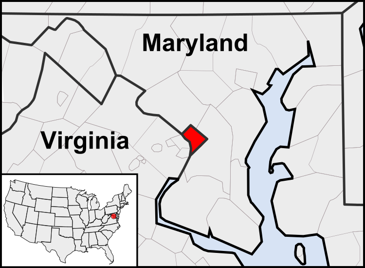
Tiedosto:Washington, D.C. locator map.svg

Tämän PNG-esikatselun koko koskien SVG-tiedostoa: 750 × 550 kuvapistettä. Muut resoluutiot: 320 × 235 kuvapistettä | 640 × 469 kuvapistettä | 1 024 × 751 kuvapistettä | 1 280 × 939 kuvapistettä | 2 560 × 1 877 kuvapistettä.
Alkuperäinen tiedosto (SVG-tiedosto; oletustarkkuus 750 × 550 kuvapistettä; tiedostokoko 160 KiB)
Tiedoston historia
Päiväystä napsauttamalla näet, millainen tiedosto oli kyseisellä hetkellä.
| Päiväys | Pienoiskuva | Koko | Käyttäjä | Kommentti | |
|---|---|---|---|---|---|
| nykyinen | 23. heinäkuuta 2011 kello 06.23 |  | 750 × 550 (160 KiB) | Patrickneil | Reverted to version as of 03:04, 23 July 2011 |
| 23. heinäkuuta 2011 kello 06.21 |  | 750 × 550 (161 KiB) | Patrickneil | Reverted to version as of 03:14, 23 July 2011 | |
| 23. heinäkuuta 2011 kello 06.20 |  | 750 × 550 (161 KiB) | Patrickneil | frame | |
| 23. heinäkuuta 2011 kello 06.14 |  | 750 × 550 (161 KiB) | Patrickneil | thicker frame | |
| 23. heinäkuuta 2011 kello 06.04 |  | 750 × 550 (160 KiB) | Patrickneil | straightening Maryland and Delaware borders | |
| 15. elokuuta 2010 kello 05.09 |  | 750 × 550 (202 KiB) | Patrickneil | Delaware River again | |
| 15. elokuuta 2010 kello 04.51 |  | 750 × 550 (274 KiB) | Patrickneil | Delaware River border | |
| 15. elokuuta 2010 kello 04.42 |  | 750 × 550 (273 KiB) | Patrickneil | forgot border on Smith Island | |
| 15. elokuuta 2010 kello 04.34 |  | 750 × 550 (273 KiB) | Patrickneil | county borders below state | |
| 15. elokuuta 2010 kello 04.32 |  | 750 × 550 (274 KiB) | Patrickneil | changes by request |
Tiedoston käyttö
Tätä tiedostoa ei käytetä millään sivulla.
Tiedoston järjestelmänlaajuinen käyttö
Seuraavat muut wikit käyttävät tätä tiedostoa:
- Käyttö kohteessa af.wikipedia.org
- Käyttö kohteessa an.wikipedia.org
- Käyttö kohteessa ar.wikipedia.org
- Käyttö kohteessa arz.wikipedia.org
- Käyttö kohteessa as.wikipedia.org
- Käyttö kohteessa azb.wikipedia.org
- Käyttö kohteessa bh.wikipedia.org
- Käyttö kohteessa bs.wikipedia.org
- Käyttö kohteessa ceb.wikipedia.org
- Käyttö kohteessa ckb.wikipedia.org
- Käyttö kohteessa en.wikipedia.org
- Käyttö kohteessa en.wikinews.org
- Käyttö kohteessa es.wikipedia.org
- Käyttö kohteessa es.wiktionary.org
- Käyttö kohteessa et.wikipedia.org
- Käyttö kohteessa fr.wikipedia.org
- Käyttö kohteessa fr.wiktionary.org
- Käyttö kohteessa fy.wikipedia.org
- Käyttö kohteessa gv.wikipedia.org
- Käyttö kohteessa hu.wikipedia.org
- Käyttö kohteessa ia.wikipedia.org
- Käyttö kohteessa id.wikipedia.org
- Käyttö kohteessa ilo.wikipedia.org
- Washington, D.C.
- Wikipedia:Ammom kadi/2013
- Plantilia:Ammom kadi/Agosto 3
- Plantilia:Ammom kadi/Septiembre 22
- Plantilia:Ammom kadi/Nobiembre 11
- Plantilia:Ammom kadi/Disiembre 31
- Plantilia:Ammom kadi/Enero 16
- Plantilia:Ammom kadi/Marso 6
- Plantilia:Ammom kadi/Abril 25
- Plantilia:Ammom kadi/Hunio 14
- Wikipedia:Umuna a Panid/Idi kalman
- Wikipedia:Nasalakniban-sariap a bambanag/Umuna a Panid/2
- Wikipedia:Nasalakniban-sariap a bambanag/Umuna a Panid/3
- Käyttö kohteessa incubator.wikimedia.org
- Käyttö kohteessa it.wikipedia.org
- Käyttö kohteessa jam.wikipedia.org
- Käyttö kohteessa ja.wikipedia.org
- Käyttö kohteessa jbo.wikipedia.org
- Käyttö kohteessa ko.wikipedia.org
- Käyttö kohteessa lb.wikipedia.org
Näytä lisää tämän tiedoston järjestelmänlaajuista käyttöä.
