Tiedosto:Rottnest Island.jpg
Tämän esikatselun koko: 800 × 399 kuvapistettä. Muut resoluutiot: 320 × 159 kuvapistettä | 857 × 427 kuvapistettä.
Alkuperäinen tiedosto (857 × 427 kuvapistettä, 47 KiB, MIME-tyyppi: image/jpeg)
| Tämä tiedosto on tiedostotietokanta Wikimedia Commonsista. Tiedot kuvaussivulta näkyvät alla. |  |
Tiedoston kuvaussivu Commonsissa |
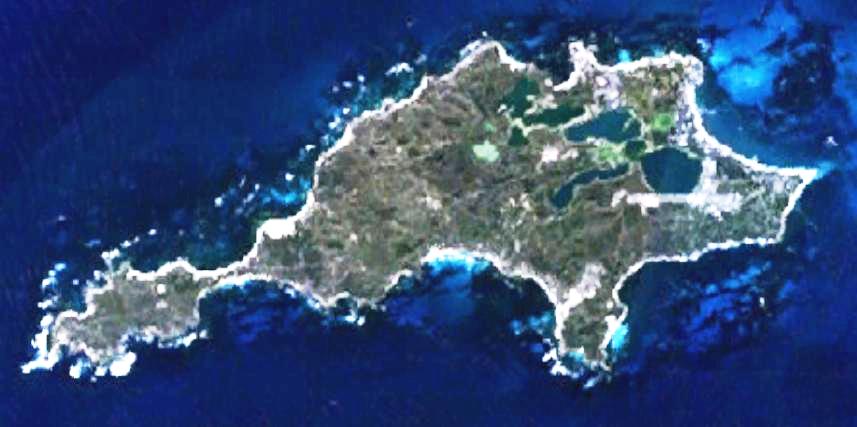
| Kuvaus | This is a map of the Rottnest Island, Western Australia. | |||
| Lähde | It was made by the uploader using NASA World Wind using Landsat 7 data. | |||
| Tekijä | Created by the uploader. Any IP involved in the creation of this image is released into the public domain. | |||
| Käyttöoikeus (Tämän tiedoston uudelleenkäyttö) |
|

Tiedoston historia
Päiväystä napsauttamalla näet, millainen tiedosto oli kyseisellä hetkellä.
| Päiväys | Pienoiskuva | Koko | Käyttäjä | Kommentti | |
|---|---|---|---|---|---|
| nykyinen | 24. kesäkuuta 2008 kello 02.28 | | 857 × 427 (47 KiB) | Hesperian | Reverted to version as of 01:37, 1 May 2007 |
| 1. toukokuuta 2007 kello 04.37 |  | 857 × 427 (47 KiB) | Moondyne | {{Information |Description=This is a map of the Rottnest Island, Western Australia, made with World Wind using Landsat 7 data. (Adjusted for contrast) |Source= |Date= |Author=Created by the uploader. Any IP involved in the creation of this image is relea | |
| 16. marraskuuta 2006 kello 06.16 |  | 857 × 427 (38 KiB) | Hesperian | {{Information |Description=This is a map of the Rottnest Island, Western Australia, made with World Wind using Landsat 7 data. |Source= |Date= |Author=Created by the uploader. Any IP involved in the creation of this image is released into the public domai |
Tiedoston käyttö
Seuraava sivu käyttää tätä tiedostoa:
Tiedoston järjestelmänlaajuinen käyttö
Seuraavat muut wikit käyttävät tätä tiedostoa:
- Käyttö kohteessa cs.wikipedia.org
- Käyttö kohteessa en.wikipedia.org
- Käyttö kohteessa fa.wikipedia.org
- Käyttö kohteessa fr.wikipedia.org
- Käyttö kohteessa gl.wikipedia.org
- Käyttö kohteessa he.wikipedia.org
- Käyttö kohteessa id.wikipedia.org
- Käyttö kohteessa ja.wikipedia.org
- Käyttö kohteessa ru.wikipedia.org
- Käyttö kohteessa ur.wikipedia.org
- Käyttö kohteessa www.wikidata.org
- Käyttö kohteessa zh-yue.wikipedia.org
- Käyttö kohteessa zh.wikipedia.org