Tiedosto:Location map of AegeanIslands (Greece).svg

Tämän PNG-esikatselun koko koskien SVG-tiedostoa: 693 × 599 kuvapistettä. Muut resoluutiot: 278 × 240 kuvapistettä | 555 × 480 kuvapistettä | 888 × 768 kuvapistettä | 1 184 × 1 024 kuvapistettä | 2 369 × 2 048 kuvapistettä | 8 460 × 7 315 kuvapistettä.
Alkuperäinen tiedosto (SVG-tiedosto; oletustarkkuus 8 460 × 7 315 kuvapistettä; tiedostokoko 1,87 MiB)
| Tämä tiedosto on tiedostotietokanta Wikimedia Commonsista. Tiedot kuvaussivulta näkyvät alla. | .svg?uselang=fi) |
Tiedoston kuvaussivu Commonsissa |
Yhteenveto
| Kuvaus |
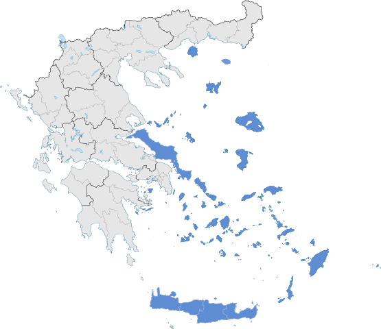
English: The location of Greek Aegean Islands within Greece. |
| Päiväys | |
| Lähde | Oma teos |
| Tekijä | SilentResident,Philly boy92 |
Lisenssi
Minä, tämän teoksen tekijänoikeuksien haltija, julkaisen täten tämän teoksen seuraavalla lisenssillä:
Tämä tiedosto on lisensoitu Creative Commons Nimeä-JaaSamoin 3.0 Ei sovitettu -lisenssillä.
- Voit:
- jakaa – kopioida, levittää ja esittää teosta
- remiksata – valmistaa muutettuja teoksia
- Seuraavilla ehdoilla:
- nimeäminen – Sinun on mainittava lähde asianmukaisesti, tarjottava linkki lisenssiin sekä merkittävä, mikäli olet tehnyt muutoksia. Voit tehdä yllä olevan millä tahansa kohtuullisella tavalla, mutta et siten, että annat ymmärtää lisenssinantajan suosittelevan sinua tai teoksen käyttöäsi.
- jaa samoin – Jos muutat tai perustat tähän työhön, voit jakaa tuloksena syntyvää työtä vain tällä tai tämän kaltaisella lisenssillä.
Tiedoston historia
Päiväystä napsauttamalla näet, millainen tiedosto oli kyseisellä hetkellä.
| Päiväys | Pienoiskuva | Koko | Käyttäjä | Kommentti | |
|---|---|---|---|---|---|
| nykyinen | 18. heinäkuuta 2021 kello 09.10 | | 8 460 × 7 315 (1,87 MiB) | SilentResident | Correcting Euboea and Crete, which for some strange reason I missed marking them as Aegean Islands even though they are. |
| 21. elokuuta 2018 kello 06.22 |  | 8 460 × 7 315 (1,83 MiB) | SilentResident | Reverted to version as of 17:09, 17 January 2015 (UTC) The islands are part of geographical Aegean Sea nevertheless. | |
| 25. maaliskuuta 2016 kello 14.28 |  | 8 460 × 7 315 (1,37 MiB) | Nikospag | Thasos and Sporades are not part of Aegean Islands region | |
| 17. tammikuuta 2015 kello 20.09 |  | 8 460 × 7 315 (1,83 MiB) | SilentResident | {{Information |Description ={{en|1=The location of Greek Aegean Islands within Greece.}} |Source ={{own}} |Author =SilentResident,Philly boy92 |Date =2014-01-17 |Permission... |
Tiedoston käyttö
Seuraava sivu käyttää tätä tiedostoa:
Tiedoston järjestelmänlaajuinen käyttö
Seuraavat muut wikit käyttävät tätä tiedostoa:
- Käyttö kohteessa ar.wikipedia.org
- Käyttö kohteessa el.wikipedia.org
- Käyttö kohteessa en.wikipedia.org
- Käyttö kohteessa eu.wikipedia.org
- Käyttö kohteessa fr.wikipedia.org
- Käyttö kohteessa hyw.wikipedia.org
- Käyttö kohteessa ml.wikipedia.org
- Käyttö kohteessa sr.wikipedia.org
- Käyttö kohteessa ta.wikipedia.org
- Käyttö kohteessa th.wikipedia.org
- Käyttö kohteessa www.wikidata.org
.svg)