Alkuperäinen tiedosto(SVG-tiedosto; oletustarkkuus 451 × 451 kuvapistettä; tiedostokoko 11 KiB)

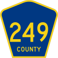
Kuvaus Diagram of a 450 mm by 450 mm (18 in by 18 in) county route marker, made to the specifications of the 2004 edition of Standard Highway Signs or the 2012 Supplement to the 2004 edition (sign M1-6). Uses the Roadgeek 2005 fonts. (United States law does not permit the copyrighting of typeface designs, and the fonts are meant to be copies of a U.S. Government-produced work anyway.) Colors are from the Federal Highway Administration's MUTCD Color Specifications (Pantone Blue 294 and Yellow 116). A gray, 1-pixel stroke was added to diagrams based on the 2012 specification to clearly show the border. In reality, signs have no such stroke.
Päiväys
Lähde Oma teos
Tekijä Fredddie
Public domain This file is in the public domain because it comes from the Manual on Uniform Traffic Control Devices, which states specifically on page I-1 that:
Any traffic control device design or application provision contained in this Manual shall be considered to be in the public domain. Traffic control devices contained in this Manual shall not be protected by a patent, trademark, or copyright, except for the Interstate Shield and any other items owned by FHWA.

Kuvatekstit

Lisää yhden rivin pituinen kuvaus tästä tiedostosta

Kohteet, joita tässä tiedostossa esitetään

esittää

17. joulukuu 2012

image/svg+xml

8fc48513ee6c20a1cc814fef36bdf9e923ae351c

10 987 tavu

451 pikseli

451 pikseli

Tiedoston historia

Päiväystä napsauttamalla näet, millainen tiedosto oli kyseisellä hetkellä.

PäiväysPienoiskuvaKokoKäyttäjäKommentti
nykyinen17. joulukuuta 2012 kello 03.34Pienoiskuva 17. joulukuuta 2012 kello 03.34 tallennetusta versiosta451 × 451 (11 KiB)Fredddie{{Information |Description={{county}} |Source={{own}} |Date=2012-12-17 |Author= Fredddie |Permission= |other_versions= }} {{PD-MUTCD}} Category:Diagrams of county route markers without county name

Seuraava sivu käyttää tätä tiedostoa:

Tiedoston järjestelmänlaajuinen käyttö

Metatieto