Tiedosto:Nasa world wind - teneriffa.jpg

Tämän esikatselun koko: 800 × 599 kuvapistettä. Muut resoluutiot: 320 × 240 kuvapistettä | 640 × 479 kuvapistettä | 1 024 × 766 kuvapistettä | 1 280 × 958 kuvapistettä.
Alkuperäinen tiedosto (1 280 × 958 kuvapistettä, 120 KiB, MIME-tyyppi: image/jpeg)
Tiedoston historia
Päiväystä napsauttamalla näet, millainen tiedosto oli kyseisellä hetkellä.
| Päiväys | Pienoiskuva | Koko | Käyttäjä | Kommentti | |
|---|---|---|---|---|---|
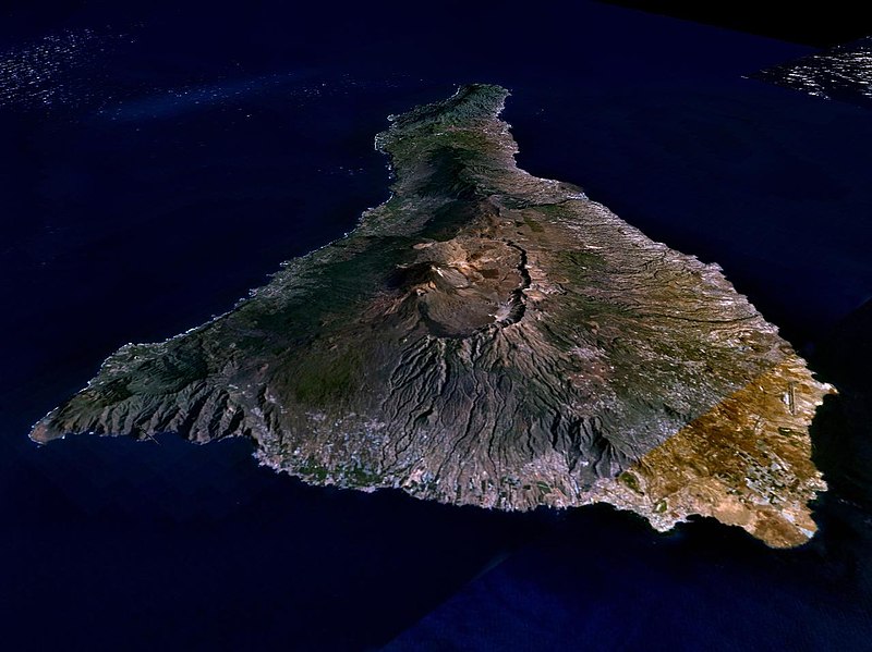
| nykyinen | 31. maaliskuuta 2005 kello 04.15 |  | 1 280 × 958 (120 KiB) | Simplicius | {{NASA-PD}} Teneriffa from the west side. One sees Teide (3,700 meters) and the Caldera (2,000 m). To the right hand the new airport. On the left side one sees that there is more humidity and therefore vegetation at the north side of the island. |
Tiedoston käyttö
Seuraava sivu käyttää tätä tiedostoa:
Tiedoston järjestelmänlaajuinen käyttö
Seuraavat muut wikit käyttävät tätä tiedostoa:
- Käyttö kohteessa ar.wikipedia.org
- Käyttö kohteessa be-tarask.wikipedia.org
- Käyttö kohteessa cs.wikipedia.org
- Käyttö kohteessa de.wikipedia.org
- Käyttö kohteessa de.wikinews.org
- Käyttö kohteessa de.wikivoyage.org
- Käyttö kohteessa en.wiktionary.org
- Käyttö kohteessa eo.wikipedia.org
- Käyttö kohteessa es.wikipedia.org
- Käyttö kohteessa fa.wikipedia.org
- Käyttö kohteessa frr.wikipedia.org
- Käyttö kohteessa fy.wikipedia.org
- Käyttö kohteessa gl.wikipedia.org
- Käyttö kohteessa he.wikipedia.org
- Käyttö kohteessa hu.wikipedia.org
- Käyttö kohteessa incubator.wikimedia.org
- Käyttö kohteessa it.wikipedia.org
- Käyttö kohteessa mn.wikipedia.org
- Käyttö kohteessa nn.wikipedia.org
- Käyttö kohteessa no.wikipedia.org
- Käyttö kohteessa pl.wiktionary.org
- Käyttö kohteessa ru.wikipedia.org
- Käyttö kohteessa sh.wikipedia.org
- Käyttö kohteessa sk.wikipedia.org
- Käyttö kohteessa sw.wikipedia.org
- Käyttö kohteessa tr.wikipedia.org
- Käyttö kohteessa uk.wikipedia.org
- Käyttö kohteessa vi.wikivoyage.org
- Käyttö kohteessa zgh.wikipedia.org

