Tiedosto:Morgan City Louisiana aerial view.jpg

Tämän esikatselun koko: 800 × 533 kuvapistettä. Muut resoluutiot: 320 × 213 kuvapistettä | 640 × 427 kuvapistettä | 1 024 × 683 kuvapistettä | 1 500 × 1 000 kuvapistettä.
Alkuperäinen tiedosto (1 500 × 1 000 kuvapistettä, 622 KiB, MIME-tyyppi: image/jpeg)
| Tämä tiedosto on tiedostotietokanta Wikimedia Commonsista. Tiedot kuvaussivulta näkyvät alla. |  |
Tiedoston kuvaussivu Commonsissa |
| Kuvaus |
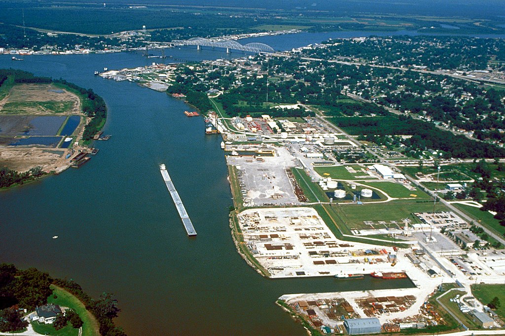
English: Aerial view of the port of Morgan City, Louisiana, USA. The Atchafalaya River flows from right to left in the background. These waterways are part of the Gulf Intracoastal Waterway. View is to the west. |
|||
| Päiväys | ||||
| Lähde |
U.S. Army Corps of Engineers Digital Visual Library Image page Image description page Digital Visual Library home page |
|||
| Tekijä | Arthur Belala, U.S. Army Corps of Engineers | |||
| Käyttöoikeus (Tämän tiedoston uudelleenkäyttö) |
|
|||
| Kuvauspaikka | Morgan City, Louisiana, USA |
| Kameran sijainti | | Tämä ja muut kuvat kartalla: OpenStreetMap |
|---|
Tiedoston historia
Päiväystä napsauttamalla näet, millainen tiedosto oli kyseisellä hetkellä.
| Päiväys | Pienoiskuva | Koko | Käyttäjä | Kommentti | |
|---|---|---|---|---|---|
| nykyinen | 1. huhtikuuta 2007 kello 08.43 | | 1 500 × 1 000 (622 KiB) | DanMS | {{Information | Description = {{en|Aerial view of the port of Morgan City, Louisiana, USA. The Atchafalaya River flows from right to left in the background. These waterways are part of the Gulf Intracoastal Waterway.}} | Source = U.S. Army Corp |
Tiedoston käyttö
Seuraava sivu käyttää tätä tiedostoa:
Tiedoston järjestelmänlaajuinen käyttö
Seuraavat muut wikit käyttävät tätä tiedostoa:
- Käyttö kohteessa azb.wikipedia.org
- Käyttö kohteessa ceb.wikipedia.org
- Käyttö kohteessa de.wikipedia.org
- Käyttö kohteessa fa.wikipedia.org
- Käyttö kohteessa fr.wikipedia.org
- Käyttö kohteessa it.wikipedia.org
- Käyttö kohteessa nl.wikipedia.org
- Käyttö kohteessa pl.wikipedia.org
- Käyttö kohteessa pt.wikipedia.org
- Käyttö kohteessa sh.wikipedia.org
- Käyttö kohteessa sr.wikipedia.org
- Käyttö kohteessa tr.wikipedia.org
- Käyttö kohteessa uk.wikipedia.org
- Käyttö kohteessa zh-min-nan.wikipedia.org