Tiedosto:Map of Minnesota highlighting Crow Wing County.svg

Tämän PNG-esikatselun koko koskien SVG-tiedostoa: 527 × 600 kuvapistettä. Muut resoluutiot: 211 × 240 kuvapistettä | 422 × 480 kuvapistettä | 675 × 768 kuvapistettä | 900 × 1 024 kuvapistettä | 1 800 × 2 048 kuvapistettä | 5 746 × 6 539 kuvapistettä.
Alkuperäinen tiedosto (SVG-tiedosto; oletustarkkuus 5 746 × 6 539 kuvapistettä; tiedostokoko 104 KiB)
| Tämä tiedosto on tiedostotietokanta Wikimedia Commonsista. Tiedot kuvaussivulta näkyvät alla. |  |
Tiedoston kuvaussivu Commonsissa |
Yhteenveto
| Kuvaus |
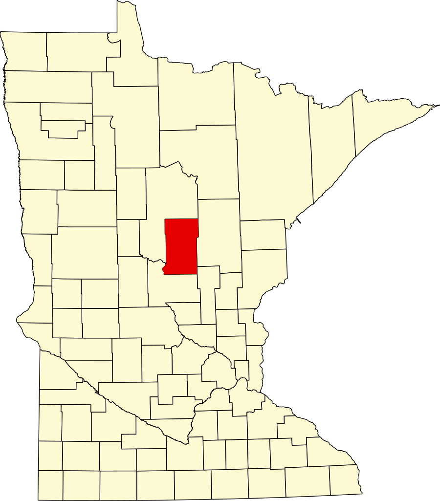
English: This is a locator map showing Crow Wing County in Minnesota. For more information, see Commons:United States county locator maps. |
| Päiväys | |
| Lähde |
Oma teos: English: The maps use data from nationalatlas.gov, specifically countyp020.tar.gz on the Raw Data Download page. The maps also use state outline data from statesp020.tar.gz. The Florida maps use hydrogm020.tar.gz to display Lake Okeechobee. |
| Tekijä | David Benbennick |
Lisenssi
| Minä, tämän teoksen tekijänoikeudellinen omistaja, julkaisen tämän teoksen public domainiin eli luovun kaikista tekijänoikeuksista lain sallimissa puitteissa. Tämä on voimassa maailmanlaajuisesti. Joissain maissa laki ei mahdollista tätä. Mikäli näin on: Myönnän kenelle tahansa oikeuden käyttää tätä teosta mihin tahansa tarkoitukseen, ilman mitään ehtoja, ellei laki vaadi ehtojen asettamista. |
Tiedoston historia
Päiväystä napsauttamalla näet, millainen tiedosto oli kyseisellä hetkellä.
| Päiväys | Pienoiskuva | Koko | Käyttäjä | Kommentti | |
|---|---|---|---|---|---|
| nykyinen | 12. helmikuuta 2006 kello 16.13 | | 5 746 × 6 539 (104 KiB) | David Benbennick | {{subst:User:Dbenbenn/clm|county=Crow Wing County|state=Minnesota|type=county}} |
| 12. helmikuuta 2006 kello 16.02 |  | 5 746 × 6 539 (104 KiB) | David Benbennick | {{subst:User:Dbenbenn/clm|county=Crow Wing County|state=Minnesota|type=county}} |
Tiedoston käyttö
Seuraava sivu käyttää tätä tiedostoa:
Tiedoston järjestelmänlaajuinen käyttö
Seuraavat muut wikit käyttävät tätä tiedostoa:
- Käyttö kohteessa ar.wikipedia.org
- Käyttö kohteessa bg.wikipedia.org
- Käyttö kohteessa bpy.wikipedia.org
- Käyttö kohteessa cdo.wikipedia.org
- Käyttö kohteessa ceb.wikipedia.org
- Käyttö kohteessa cy.wikipedia.org
- Käyttö kohteessa da.wikipedia.org
- Käyttö kohteessa de.wikipedia.org
- Liste der Countys in Minnesota
- Crow Wing County
- Brainerd (Minnesota)
- Pequot Lakes
- Liste der Einträge im National Register of Historic Places im Crow Wing County
- Baxter (Minnesota)
- Breezy Point (Minnesota)
- Vorlage:Navigationsleiste Orte im Crow Wing County
- Crosby (Minnesota)
- Crosslake
- Nisswa
- Merrifield (Minnesota)
- Käyttö kohteessa en.wikipedia.org
Näytä lisää tämän tiedoston järjestelmänlaajuista käyttöä.