Tiedosto:Lewes UK locator map.svg

Tämän PNG-esikatselun koko koskien SVG-tiedostoa: 800 × 521 kuvapistettä. Muut resoluutiot: 320 × 208 kuvapistettä | 640 × 417 kuvapistettä | 1 024 × 667 kuvapistettä | 1 280 × 834 kuvapistettä | 2 560 × 1 667 kuvapistettä | 1 425 × 928 kuvapistettä.
Alkuperäinen tiedosto (SVG-tiedosto; oletustarkkuus 1 425 × 928 kuvapistettä; tiedostokoko 787 KiB)
| Tämä tiedosto on tiedostotietokanta Wikimedia Commonsista. Tiedot kuvaussivulta näkyvät alla. |  |
Tiedoston kuvaussivu Commonsissa |
| Kuvaus |
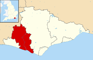
Map of East Sussex, UK with Lewes district highlighted. Equirectangular map projection on WGS 84 datum, with N/S stretched 155% |
| Päiväys | |
| Lähde |
|
| Tekijä | Nilfanion, created using Ordnance Survey data |
| Käyttöoikeus (Tämän tiedoston uudelleenkäyttö) |
Tämä tiedosto on lisensoitu Creative Commons Nimeä-JaaSamoin 3.0 Ei sovitettu -lisenssillä. Nimeä: Contains Ordnance Survey data © Crown copyright and database right
|
Tiedoston historia
Päiväystä napsauttamalla näet, millainen tiedosto oli kyseisellä hetkellä.
| Päiväys | Pienoiskuva | Koko | Käyttäjä | Kommentti | |
|---|---|---|---|---|---|
| nykyinen | 10. maaliskuuta 2011 kello 14.35 | | 1 425 × 928 (787 KiB) | Nilfanion | {{Information |Description=Map of East Sussex, UK with Lewes district highlighted. Equirectangular map projection on WGS 84 datum, with N/S stretched 155% |Source=Ordnance Survey [https://www |
Tiedoston käyttö
Tätä tiedostoa ei käytetä millään sivulla.
Tiedoston järjestelmänlaajuinen käyttö
Seuraavat muut wikit käyttävät tätä tiedostoa:
- Käyttö kohteessa ast.wikipedia.org
- Käyttö kohteessa cy.wikipedia.org
- Käyttö kohteessa en.wikipedia.org
- Käyttö kohteessa es.wikipedia.org
- Käyttö kohteessa fr.wikipedia.org
- Lewes
- Newhaven (Sussex de l'Est)
- Firle
- Seaford
- Rodmell
- District de Lewes
- Kingston near Lewes
- Southease
- Falmer
- Ditchling
- Peacehaven
- Ringmer
- Bishopstone (Sussex de l'Est)
- Beddingham
- Modèle:Palette District de Lewes
- Chailey
- East Chiltington
- Glynde
- Hamsey
- Piddinghoe
- Westmeston
- Streat
- Tarring Neville
- Barcombe
- South Heighton
- Telscombe
- Wivelsfield
- Plumpton (Sussex de l'Est)
- Newick (Royaume-Uni)
- Iford
- Käyttö kohteessa ja.wikipedia.org
- Käyttö kohteessa ko.wikipedia.org
- Käyttö kohteessa no.wikipedia.org
- Käyttö kohteessa pl.wikipedia.org
- Käyttö kohteessa pl.wiktionary.org
- Käyttö kohteessa ru.wikipedia.org
- Käyttö kohteessa sh.wikipedia.org
- Käyttö kohteessa sv.wikipedia.org
- Käyttö kohteessa ur.wikipedia.org
- Käyttö kohteessa www.wikidata.org
- Käyttö kohteessa zh-min-nan.wikipedia.org