Tiedosto:Colonisation 1660.png

Alkuperäinen tiedosto (4 000 × 1 754 kuvapistettä, 1,13 MiB, MIME-tyyppi: image/png)
| Tämä tiedosto on tiedostotietokanta Wikimedia Commonsista. Tiedot kuvaussivulta näkyvät alla. |  |
Tiedoston kuvaussivu Commonsissa |
| Kuvaus |
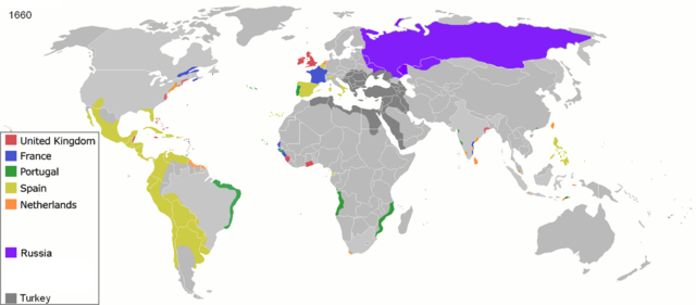
Map of major world powers by year, derived from public domain animated map on wikipedia.
As the orriginal licence of the animation was Public Domain, this image which has been derived from it is too:
|
||||||||||||||||||
| Päiväys | |||||||||||||||||||
| Lähde | public domain animated map by ArdadN here | ||||||||||||||||||
| Tekijä | ArdadN | ||||||||||||||||||
.jpg)
._LOC_2001620596.jpg)

|
Tämä tyyppiä historical map oleva kuva pitäisi luoda uudelleen SVG-tiedostoksi vektorigrafiikan avulla. Tällä tiedostotyypillä on monia vahvuuksia, sivulta Commons:Media for cleanup löytyy lisätietoja. Jos tästä kuvasta on jo olemassa SVG-versio, ole ystävällinen ja tallenna se tänne. SVG-tiedoston tallentamisen jälkeen vaihda tämä malline mallineeseen {{vector version available|uusi kuvan nimi.svg}}.
|
Tiedoston historia
Päiväystä napsauttamalla näet, millainen tiedosto oli kyseisellä hetkellä.
| Päiväys | Pienoiskuva | Koko | Käyttäjä | Kommentti | |
|---|---|---|---|---|---|
| nykyinen | 3. lokakuuta 2020 kello 20.11 | | 4 000 × 1 754 (1,13 MiB) | Ориенталист | color correction, minus Courland |
| 4. huhtikuuta 2020 kello 15.40 |  | 4 275 × 1 875 (1,06 MiB) | Devlet Geray | Again, Russian got Azov in 1696 (this is 1660 map) for the first time and then lost in 1711, and in 1739 got it for the second time. The Pravoberezhnaya Ukraine wasn't annexed by Russia until Ekaterina's the Second rule | |
| 4. huhtikuuta 2020 kello 15.12 |  | 4 275 × 1 875 (1,17 MiB) | Ориенталист | Russian reached pacific ocean to 1640s. In 1650s there were a war between Russia and China at Amur river. You perfectly know it. Stop stalking me | |
| 4. huhtikuuta 2020 kello 14.57 |  | 1 425 × 625 (48 KiB) | Devlet Geray | If you had attended history classes at school, you would know know that Russia didn't get Левобережная Украина under Aleksey Michaylovich's rule, nor it got Azov until 1739 | |
| 4. huhtikuuta 2020 kello 14.46 |  | 1 425 × 625 (39 KiB) | Devlet Geray | Reverted to version as of 22:30, 31 March 2020 (UTC) | |
| 3. huhtikuuta 2020 kello 20.03 |  | 4 275 × 1 875 (1,17 MiB) | Ориенталист | Reverted to version as of 14:24, 27 March 2020 (UTC) | |
| 1. huhtikuuta 2020 kello 01.30 |  | 1 425 × 625 (39 KiB) | Devlet Geray | Reverted to version as of 13:41, 6 December 2014 (UTC) | |
| 27. maaliskuuta 2020 kello 17.24 |  | 4 275 × 1 875 (1,17 MiB) | Ориенталист | Clarified the territory of Russia. By 1660, the Russians had already reached the Pacific Ocean | |
| 6. joulukuuta 2014 kello 16.41 |  | 1 425 × 625 (39 KiB) | AmbroiseL | I added the couronian empire (Gambia, Tobago, Courland & Semigallia) | |
| 24. tammikuuta 2011 kello 03.34 |  | 1 425 × 625 (76 KiB) | Micsha~commonswiki | Reverted to version as of 01:02, 30 April 2010 |
Tiedoston käyttö
Seuraava sivu käyttää tätä tiedostoa:
Tiedoston järjestelmänlaajuinen käyttö
Seuraavat muut wikit käyttävät tätä tiedostoa:
- Käyttö kohteessa ast.wikipedia.org
- Käyttö kohteessa el.wikipedia.org
- Käyttö kohteessa en.wikipedia.org
- Käyttö kohteessa es.wikipedia.org
- Käyttö kohteessa fr.wikipedia.org
- Käyttö kohteessa he.wikipedia.org
- Käyttö kohteessa no.wikipedia.org
- Käyttö kohteessa oc.wikipedia.org