Tiedosto:AgrihanNASA.jpg

Tämän esikatselun koko: 800 × 535 kuvapistettä. Muut resoluutiot: 320 × 214 kuvapistettä | 640 × 428 kuvapistettä | 1 000 × 669 kuvapistettä.
Alkuperäinen tiedosto (1 000 × 669 kuvapistettä, 144 KiB, MIME-tyyppi: image/jpeg)
| Tämä tiedosto on tiedostotietokanta Wikimedia Commonsista. Tiedot kuvaussivulta näkyvät alla. |  |
Tiedoston kuvaussivu Commonsissa |
Yhteenveto
| Kuvaus |
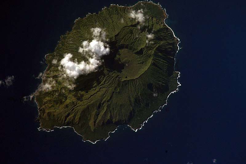
English: NASA Space Shuttle image of Agrihan island in the Northern Mariana Islands.
|
||||||||||||||||||||||||||||||||||||||||||||||||||
| Kuvauspaikka | Northern Mariana Islands | ||||||||||||||||||||||||||||||||||||||||||||||||||
| Päiväys | |||||||||||||||||||||||||||||||||||||||||||||||||||
| Lähde |
|
||||||||||||||||||||||||||||||||||||||||||||||||||
| Tekijä | NASA | ||||||||||||||||||||||||||||||||||||||||||||||||||
| Kohteen sijainti | | Tämä ja muut kuvat kartalla: OpenStreetMap |
|---|
This image or video was catalogued by one of the centers of the United States National Aeronautics and Space Administration (NASA) under Photo ID: ISS006-E-42419. This tag does not indicate the copyright status of the attached work. A normal copyright tag is still required. See Commons:Licensing. Other languages:
|
Lisenssi
This file is in the public domain in the United States because it was created by the Image Science & Analysis Laboratory, of the NASA Johnson Space Center. NASA copyright policy states that "NASA material is not protected by copyright unless noted". (NASA media use guidelines or Conditions of Use of Astronaut Photographs).
Photo source: ISS006-E-42419.
|
Tiedoston historia
Päiväystä napsauttamalla näet, millainen tiedosto oli kyseisellä hetkellä.
| Päiväys | Pienoiskuva | Koko | Käyttäjä | Kommentti | |
|---|---|---|---|---|---|
| nykyinen | 22. huhtikuuta 2007 kello 07.54 | | 1 000 × 669 (144 KiB) | Seattle Skier | == Summary == {{Information |Description= NASA Space Shuttle image of Agrihan island in the Northern Mariana Islands. |Source= http://www.oceandots.com/pacific/mariana/agrihan.htm |Date= 01 April 2003 |Location = [[Northern Mariana Islands |
Tiedoston käyttö
Seuraava sivu käyttää tätä tiedostoa:
Tiedoston järjestelmänlaajuinen käyttö
Seuraavat muut wikit käyttävät tätä tiedostoa:
- Käyttö kohteessa arz.wikipedia.org
- Käyttö kohteessa ast.wikipedia.org
- Käyttö kohteessa ceb.wikipedia.org
- Käyttö kohteessa de.wikipedia.org
- Käyttö kohteessa en.wikipedia.org
- Käyttö kohteessa en.wiktionary.org
- Käyttö kohteessa eo.wikipedia.org
- Käyttö kohteessa es.wikipedia.org
- Käyttö kohteessa et.wikipedia.org
- Käyttö kohteessa fa.wikipedia.org
- Käyttö kohteessa fr.wikipedia.org
- Käyttö kohteessa fr.wikiquote.org
- Käyttö kohteessa gcr.wikipedia.org
- Käyttö kohteessa gl.wikipedia.org
- Käyttö kohteessa it.wikipedia.org
- Käyttö kohteessa ja.wikipedia.org
- Käyttö kohteessa ka.wikipedia.org
- Käyttö kohteessa ko.wikipedia.org
- Käyttö kohteessa lld.wikipedia.org
- Käyttö kohteessa ms.wikipedia.org
- Käyttö kohteessa mzn.wikipedia.org
- Käyttö kohteessa nl.wikipedia.org
- Käyttö kohteessa pl.wikipedia.org
- Käyttö kohteessa pt.wiktionary.org
- Käyttö kohteessa ru.wikipedia.org
- Käyttö kohteessa ru.wiktionary.org
- Käyttö kohteessa sk.wikipedia.org
- Käyttö kohteessa sv.wikipedia.org
- Käyttö kohteessa ur.wikipedia.org
- Käyttö kohteessa vi.wikipedia.org
- Käyttö kohteessa www.wikidata.org
- Käyttö kohteessa zh.wikipedia.org