Tiedosto:Map of Virginia Counties and Independent Cities.svg

Tämän PNG-esikatselun koko koskien SVG-tiedostoa: 800 × 371 kuvapistettä. Muut resoluutiot: 320 × 149 kuvapistettä | 640 × 297 kuvapistettä | 1 024 × 475 kuvapistettä | 1 280 × 594 kuvapistettä | 2 560 × 1 189 kuvapistettä | 1 260 × 585 kuvapistettä.
Alkuperäinen tiedosto (SVG-tiedosto; oletustarkkuus 1 260 × 585 kuvapistettä; tiedostokoko 220 KiB)
| Tämä tiedosto on tiedostotietokanta Wikimedia Commonsista. Tiedot kuvaussivulta näkyvät alla. |  |
Tiedoston kuvaussivu Commonsissa |
| Kuvaus |
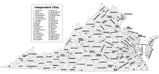
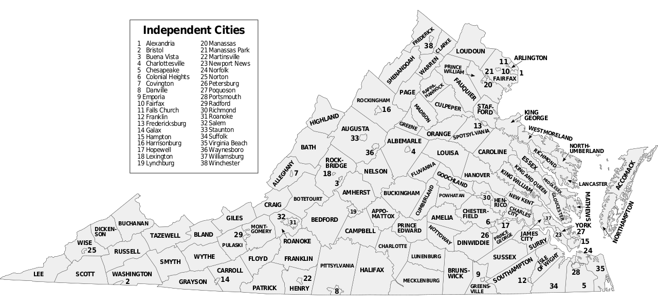
Map of Virginia counties and independent cities, SVG format. David Benbennick made the outline map modified here. For more information, see Commons:United States county locator maps. |
||
| Päiväys | (UTC) | ||
| Lähde | |||
| Tekijä | |||
| SVG kehittely | Tämä vektorigrafiikkatiedosto luotiin käyttäen apuna ohjelmaa Inkscape.
|
Tämä tiedosto on lisensoitu Creative Commons Nimeä-JaaSamoin 3.0 Ei sovitettu -lisenssillä.
- Voit:
- jakaa – kopioida, levittää ja esittää teosta
- remiksata – valmistaa muutettuja teoksia
- Seuraavilla ehdoilla:
- nimeäminen – Sinun on mainittava lähde asianmukaisesti, tarjottava linkki lisenssiin sekä merkittävä, mikäli olet tehnyt muutoksia. Voit tehdä yllä olevan millä tahansa kohtuullisella tavalla, mutta et siten, että annat ymmärtää lisenssinantajan suosittelevan sinua tai teoksen käyttöäsi.
- jaa samoin – Jos muutat tai perustat tähän työhön, voit jakaa tuloksena syntyvää työtä vain tällä tai tämän kaltaisella lisenssillä.
Alkuperäinen tallennusloki
This image is a derivative work of the following images:
- Virginia counties and independent cities map.gif licensed with Cc-by-sa-3.0-migrated-with-disclaimers, GFDL-en
- 2006-10-16T20:34:33Z JosN 1009x491 (71702 Bytes) Map of Virginia counties and independant cities.
- Map of Virginia highlighting Floyd County.svg licensed with PD-self
- 2006-02-12T17:43:56Z David Benbennick 7486x3247 (228776 Bytes) {{subst:User:Dbenbenn/clm|county=Floyd County|state=Virginia|type=county}}
Uploaded with derivativeFX
Tiedoston historia
Päiväystä napsauttamalla näet, millainen tiedosto oli kyseisellä hetkellä.
| Päiväys | Pienoiskuva | Koko | Käyttäjä | Kommentti | |
|---|---|---|---|---|---|
| nykyinen | 9. marraskuuta 2016 kello 00.08 | | 1 260 × 585 (220 KiB) | Offnfopt | removed left over boundary from defunct city removed in previous edit and centered Bedford text |
| 8. marraskuuta 2016 kello 08.22 |  | 1 260 × 585 (219 KiB) | Offnfopt | Update per request @ W:WP:GL/MAP Bedford is no longer a city so removing from list | |
| 15. syyskuuta 2009 kello 21.43 |  | 1 260 × 585 (742 KiB) | Soundoftoday | Fit to legal-size paper | |
| 15. syyskuuta 2009 kello 21.36 |  | 7 488 × 3 249 (741 KiB) | Soundoftoday | {{Information |Description=Map of Virginia counties and independent cities. David Benbennick made the outline map modified here. For more information, see Commons:United States county locator maps. |Source=*[[:File:Virginia_countie |
Tiedoston käyttö
Seuraava sivu käyttää tätä tiedostoa:
Tiedoston järjestelmänlaajuinen käyttö
Seuraavat muut wikit käyttävät tätä tiedostoa:
- Käyttö kohteessa bjn.wikipedia.org
- Käyttö kohteessa cy.wikipedia.org
- Käyttö kohteessa en.wikipedia.org
- Käyttö kohteessa fa.wikipedia.org
- Käyttö kohteessa frr.wikipedia.org
- Käyttö kohteessa hu.wikipedia.org
- Käyttö kohteessa id.wikipedia.org
- Käyttö kohteessa pt.wikipedia.org
- Käyttö kohteessa ro.wikipedia.org
- Käyttö kohteessa ru.wikipedia.org
- Käyttö kohteessa sq.wikipedia.org
- Käyttö kohteessa tr.wikipedia.org