Tiedosto:Grand Canyon area map.png
Tarkempaa kuvaa ei ole saatavilla.
Grand_Canyon_area_map.png (632 × 510 kuvapistettä, 48 KiB, MIME-tyyppi: image/png)
| Tämä tiedosto on tiedostotietokanta Wikimedia Commonsista. Tiedot kuvaussivulta näkyvät alla. |  |
Tiedoston kuvaussivu Commonsissa |
| Kuvaus |
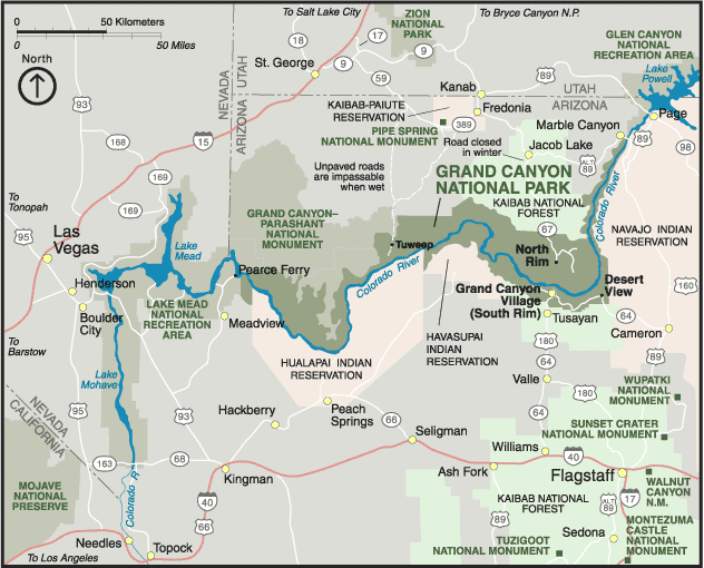
English: Map of en:Grand Canyon National Park and area. PD NPS image from http://www.nps.gov/grca/grandcanyon/maps/ |
| Lähde | http://www.nps.gov/grca/grandcanyon/maps/ |
| Tekijä | US National Park Service |
Lisenssi
| This image or media file contains material based on a work of a National Park Service employee, created as part of that person's official duties. As a work of the U.S. federal government, such work is in the public domain in the United States. See the NPS website and NPS copyright policy for more information. |
Alkuperäinen tallennusloki
Alkuperäinen kuvaussivu oli täällä. Käyttäjätunnukset alla viittaavat kohteeseen en.wikipedia.
- 2005-04-12 01:41 Mav 632×510× (49439 bytes) Map of [[Grand Canyon National Park]] and area. PD NPS image from http://www.nps.gov/grca/grandcanyon/maps/ {{PD-USGov-NPS}}
Tiedoston historia
Päiväystä napsauttamalla näet, millainen tiedosto oli kyseisellä hetkellä.
| Päiväys | Pienoiskuva | Koko | Käyttäjä | Kommentti | |
|---|---|---|---|---|---|
| nykyinen | 26. helmikuuta 2009 kello 00.23 | | 632 × 510 (48 KiB) | File Upload Bot (Magnus Manske) | {{BotMoveToCommons|en.wikipedia|year={{subst:CURRENTYEAR}}|month={{subst:CURRENTMONTHNAME}}|day={{subst:CURRENTDAY}}}} {{Information |Description={{en|Map of en:Grand Canyon National Park and area. PD NPS image from http://www.nps.gov/grca/grandcany |
Tiedoston käyttö
Seuraava sivu käyttää tätä tiedostoa:
Tiedoston järjestelmänlaajuinen käyttö
Seuraavat muut wikit käyttävät tätä tiedostoa:
- Käyttö kohteessa fa.wikipedia.org
- Käyttö kohteessa it.wikivoyage.org