Tiedosto:Crete location map.png
Crete_location_map.png (326 × 498 kuvapistettä, 28 KiB, MIME-tyyppi: image/png)
| Tämä tiedosto on tiedostotietokanta Wikimedia Commonsista. Tiedot kuvaussivulta näkyvät alla. |  |
Tiedoston kuvaussivu Commonsissa |
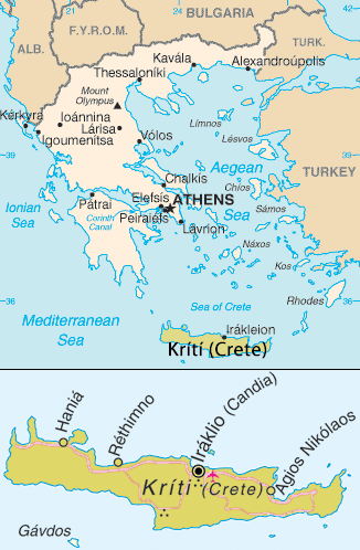
Map of Crete. Adapted from [1]
Tämä teos on peräisin Yhdysvaltain keskustiedustelupalvelun (Central Intelligence Agency, CIA) julkaisemasta The World Factbookista. Teoksen on valmistanut jonkin Yhdysvaltain liittovaltion viranomaisen työntekijä osana kyseisen työntekijän virkatointa. Yhdysvaltain liittovaltion viranomaisten työntekijöiden tekemät teokset eivät saa tekijänoikeuden suojaa Yhdysvaltain tekijänoikeuslain 105 § mukaisesti.
|
 |
| This image is a map derived from a United Nations map.
Unless stated otherwise, UN maps are to be considered in the public domain. This applies worldwide. UN maps are, in principle, open source material and you can use them in your work or for making your own map. UN requests however that you delete the UN name, logo and reference number upon any modification to the map. Content of your map will be your responsibility. You can state in your publication, if you wish, something like: based on UN map … (map name, map number, revision number and date). See: Geospatial Information Section. And: Geospatial, location data for a better world. |
 |
Tiedoston historia
Päiväystä napsauttamalla näet, millainen tiedosto oli kyseisellä hetkellä.
| Päiväys | Pienoiskuva | Koko | Käyttäjä | Kommentti | |
|---|---|---|---|---|---|
| nykyinen | 31. elokuuta 2013 kello 20.50 | | 326 × 498 (28 KiB) | Hedwig in Washington | Reverted to version as of 15:54, 26 July 2011 |
| 31. elokuuta 2013 kello 19.46 |  | 326 × 498 (28 KiB) | Makedonski Mak | Reverted to version as of 16:39, 31 August 2013 | |
| 31. elokuuta 2013 kello 19.44 |  | 326 × 498 (28 KiB) | Makedonski Mak | ||
| 31. elokuuta 2013 kello 19.39 |  | 326 × 498 (28 KiB) | Makedonski Mak | Reverted to version as of 19:32, 29 August 2013 | |
| 31. elokuuta 2013 kello 16.59 |  | 326 × 498 (87 KiB) | Tuvalkin | Needless change on a UN map: Reverted to version as of 11:15, 29 August 2013 | |
| 29. elokuuta 2013 kello 22.32 |  | 326 × 498 (28 KiB) | Makedonski Mak | Reverted to version as of 22:38, 28 August 2013 | |
| 29. elokuuta 2013 kello 22.29 |  | 326 × 498 (28 KiB) | Makedonski Mak | Reverted to version as of 22:38, 28 August 2013 | |
| 29. elokuuta 2013 kello 14.15 |  | 326 × 498 (87 KiB) | MacedonianBoy | Reverted to version as of 20:27, 28 August 2013 | |
| 29. elokuuta 2013 kello 01.38 |  | 326 × 498 (28 KiB) | MacedonianMk | Reverted to version as of 17:21, 28 August 2013 | |
| 28. elokuuta 2013 kello 23.27 |  | 326 × 498 (87 KiB) | MacedonianBoy | Reverted to version as of 00:01, 19 February 2013 |
Tiedoston käyttö
Seuraavat 3 sivua käyttävät tätä tiedostoa:
Tiedoston järjestelmänlaajuinen käyttö
Seuraavat muut wikit käyttävät tätä tiedostoa:
- Käyttö kohteessa ar.wikipedia.org
- Käyttö kohteessa ary.wikipedia.org
- Käyttö kohteessa ban.wikipedia.org
- Käyttö kohteessa be-tarask.wikipedia.org
- Käyttö kohteessa da.wikipedia.org
- Käyttö kohteessa de.wikipedia.org
- Käyttö kohteessa en.wikipedia.org
- Käyttö kohteessa eo.wikipedia.org
- Käyttö kohteessa fa.wikipedia.org
- Käyttö kohteessa hi.wikipedia.org
- Käyttö kohteessa hu.wikipedia.org
- Käyttö kohteessa id.wikipedia.org
- Käyttö kohteessa it.wikipedia.org
- Käyttö kohteessa ja.wikipedia.org
- Käyttö kohteessa jv.wikipedia.org
- Käyttö kohteessa ku.wikipedia.org
- Käyttö kohteessa ms.wikipedia.org
- Käyttö kohteessa nn.wikipedia.org
- Käyttö kohteessa pnb.wikipedia.org
- Käyttö kohteessa ro.wikivoyage.org
- Käyttö kohteessa sc.wikipedia.org
- Käyttö kohteessa simple.wikipedia.org
- Käyttö kohteessa zh-min-nan.wikipedia.org
- Käyttö kohteessa zh.wikipedia.org